


Beam Me Down, Scotty: The Use of Airborne and Satellite Technology to Measure Carbon in Hawaiian Forests
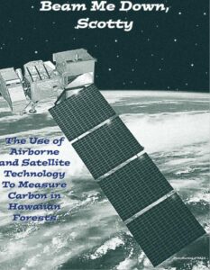
In this study, the scientists wanted to test a method of calculating the amount of carbon stored by plants across a large area of land. They chose the island of Hawai‘i to test their method. By combining both old and new technology, they could then create a carbon map of the whole island of Hawai‘i.

-
 In this FACTivity, you will answer the question, “What are the similarities and differences of two recent studies of carbon storage in tropical forests?” You will identify how these studies...
FACTivity – Beam Me Down, Scotty
In this FACTivity, you will answer the question, “What are the similarities and differences of two recent studies of carbon storage in tropical forests?” You will identify how these studies...

Glossary
View All Glossary-

Greg Asner
My favorite science experience occurred in 2009 when my team and I climbed upward from the Amazon forests into the Andes mountains in Peru. After we made it to the..."> View Profile -

R. Flint Hughes
My favorite science experience was working with local villagers in the rain forests of southern Mexico. I was working to understand how deforestation and land use were changing those forests..."> View Profile -

Amanda Uowolo
My favorite science experience occurred while collecting data on species diversity, density, and size in a forest in the Republic of Palau. We had our noses to the ground looking..."> View Profile
Standards addressed in this Article:
Social Studies Standards
- Global Connections
- Individual Development and Identity
- People, Places, and Environments
- Production, Distribution, and Consumption
- Science, Technology, and Society
- Time, Continuity, and Change
Note To Educators
The Forest Service's Mission
The Forest Service’s mission is to sustain the health, diversity, and productivity of the Nation’s forests and grasslands to meet the needs of present and future generations. For more than 100 years, our motto has been “caring for the land and serving people.” The Forest Service, an agency of the U.S. Department of Agriculture (USDA), recognizes its responsibility to be engaged in efforts to connect youth to nature and to promote the development of science-based conservation education programs and materials nationwide.

What Is the Natural Inquirer?
Natural Inquirer is a science education resource journal to be used by students in grade 6 and up. Natural Inquirer contains articles describing environmental and natural resource research conducted by Forest Service scientists and their cooperators. These scientific journal articles have been reformatted to meet the needs of middle school students. The articles are easy to understand, are aesthetically pleasing to the eye, contain glossaries, and include hands-on activities. The goal of Natural Inquirer is to stimulate critical reading and thinking about scientific inquiry and investigation while teaching about ecology, the natural environment, and natural resources.

-
Meet the Scientists
Introduces students to the scientists who did the research. This section may be used in a discussion about careers in science.
-
What Kinds of Scientist Did This Research?
Introduces students to the scientific disciplines of the scientists who conducted the research.
-
Thinking About Science
Introduces something new about the scientific process, such as a scientific habit of mind or procedures used in scientific studies.
-
Thinking About the Environment
Introduces the environmental topic being addressed in the research.
-
Introduction
Introduces the problem or question that the research addresses.
-
Method
Describes the method the scientists used to collect and analyze their data.
-
Findings & Discussion
Describes the results of the analysis. Addresses the findings and places them into the context of the original problem or question.
-
Reflection Section
Presents questions aimed at stimulating critical thinking about what has been read or predicting what might be presented in the next section. These questions are placed at the end of each of the main article sections.
-
Number Crunches
Presents an easy math problem related to the research.
-
Glossary
Defines potentially new scientific or other terms to students. The first occurrence of a glossary word is bold in the text.
-
Citation
Gives the original article citation with an internet link to the original article.
-
FACTivity
Presents a hands-on activity that emphasizes something presented in the article.
Science Education Standards
You will find a listing of education standards which are addressed by each article at the back of each publication and on our website.
We Welcome Feedback
-
Contact
Jessica Nickelsen
Forest Service -
Email
Lessons
-
 In this lesson, students will increase their reading comprehension, critical thinking skills, and summarization and explanation skills. Students will role-play as members of the Natural Inquirer Twitter Team (now X...
Lesson Plan – Twitter Team
In this lesson, students will increase their reading comprehension, critical thinking skills, and summarization and explanation skills. Students will role-play as members of the Natural Inquirer Twitter Team (now X... -
 This lesson plan can be paired with any of the cultural essays from the Hawai’i-Pacific Islands edition of Natural Inquirer. After a brief introduction, students will read the cultural essay...
Lesson Plan – Cultural Essay
This lesson plan can be paired with any of the cultural essays from the Hawai’i-Pacific Islands edition of Natural Inquirer. After a brief introduction, students will read the cultural essay...
Education Files
Care for the Land ("Mālama ‘Āina")
This research highlights the importance of Hawaiian forests as places where carbon is stored on Earth. When forests are healthy, more carbon is stored on Earth. This can prevent more carbon dioxide, or CO2, from entering the atmosphere. Most CO2 enters the atmosphere from burning fossil fuels. Too much of this gas contributes to the planet’s warming. Reducing CO2 in the atmosphere, therefore, will slow climate change. Forests also provide other benefits. They provide homes for animals, protect soil and water, and provide places for people to enjoy.
Forests provide wood and nontimber products for buildings, furniture, musical instruments, medicine, food, and art. We recognize these benefits of forests today. Because we recognize these benefits, we take action to protect our forests. Did early Hawaiians understand the benefits they received from their forests? If so, did they take action to protect their forests? What did they do?
In 1987, Marion Kelley concluded that early Hawaiians had a strong tradition of caring (“mālama”) for the land (“‘āina”). They had an unwritten rule to take only what was needed from the island forests. This unwritten rule was explained by the following proverb: “Hahai no ka ua i ka ulula‘au,”–“The rains always follow the forests.” Early Hawaiians observed that rains were associated with forests. We know now that tropical forests are dense and trees are tall where rain is plentiful. We also know that tree growth results in transpiration that can create mist and clouds that encourage rain. Because water is critical to life, the early Hawaiian observations about the relationship between rain and trees served them well. They cut down only the trees they needed. By cutting only what they needed, they made sure that rains would continue coming to their forests. Because they took only what they needed, the forests were available for generations of Hawaiians to use and enjoy.
The forests of Hawai‘i are still loved and cared for today. In the Hawaiian Islands, the concept of mālama ‘āina is passed from parents to children. For example, Kamuela Meheula-Naihe of the First Nations’ Futures Program, wrote “As a keiki, I spent most of my time outdoors. My parents taught me the concept of mālama ‘āina at a young age. I grew up always having a garden, spending a lot of time at the ocean and in the mountains. Because of these experiences [. . .] I am deeply connected to the environments around me.” (From http://www.fnfp.org/.)
How do the people in your family and community feel about the land? How do you feel about using forests and protecting them? What can we learn from the concept of mālama ‘āina?